Driving in France and Italy.

In order to scout out the living situation for our upcoming Italy trip, we decided to rent a car and see if we could drive over to Italy and back without killing one another or anyone else.  Since I am writing this you can assume we were to some degree successful.  Don’t worry!   M is here too and currently trying to catch up on the eating we missed while being gone all day.

We took the bus down to Cham this morning and managed to pick up the car with no troubles.  The car was a Peugeot 208 with a 5 speed manual and not too much horsepower. It did however like to rev really loudly and not go very fast while doing so. Handling dynamics were good though, as the car was smooth through the bends.

Without too much trouble we made it up to the Mt. Blanc tunnel which goes through the mountain for about 11 kilometers and comes out just above Courmayeur, Italy.  There are very strict rules to follow when in the tunnel and are as follows.  The speed limit is 50-70 kph and you MUST maintain a minimum distance of 150 meters between yourself and the car in front of you.  Consequences for disobeying these rules include fines of 800 Euros as well as losing your license.  Though strict, these rules might have some possibilities of helping I-70 traffic with a few modifications!

Everything was going swimmingly until we missed our turn for Courmayeur.  This was a huge mistake.  If you miss the turn, you will basically have to drive to Milan in order to turn around because there are no off ramps for many miles.  You will also get to see none of the beauty you are missing because most of the road is covered with tunnels.  I imagine that after 12-15 miles of going the wrong way, most sane people will do as we did and break the law by turning around in one of the tiny little passages in the median.  Fortunately the Italian 5-0 was not around to arrest us.  Of course they would have to have been at that exact spot or they would have had to drive 50 miles the other way so they could turn around and come to get us.

By this time, M and I were not on polite speaking terms due to miscommunication regarding our previous direction.  Really, I’d like to blame Google for that because Google maps could not keep up with where we were on the road.

After many extra miles we made it to the parking lot in Dolonne which is a hamlet of  Courmayeur.  We were able to find our lodgings for our upcoming trip along with the main square of town which has many gelato options.  Wandering around Courmayeur isn’t so bad really considering the view.

B49182B2-9244-48EB-B9F7-4457B7D20176

We went for a little run and ended with a stop at one of the gelato places and all was right with the world.  A refreshing strawberry, or in M’s case, a refreshing Nutella, Oreo, vanilla gelato, will certainly take away whatever troubles you might have had.

It ended up being a much longer day than it probably should’ve been, but we made it home safely and are very happy with our accumulated knowledge of driving around France and Italy.

We finished our biggest training day ever!

As we started up the first climb, the song that says, “25 miles from home girl, my feet are hurting mighty bad…” was playing through my mind since that is how far we had to go. That and 3 big climbs totaling 9,000 feet.

9A131688-4308-4E0E-B825-A1BA3C5F09A5
Top of first climb looking down on Le Tour.

I let out a sarcastic shout when made it to the top of the first part of the first climb. Sarcastic because we only had another 1,000 vertical feet or so to go up.  As usual we saw some Ibex, including one who was doing his business in the middle of the trail.  He looked kind of upset that we interrupted him, but he did get out of the way when he was finished.

8E45316B-1B57-411F-B1F5-0948A0C8B2F8
That little town is Vallorcine, which is where we were headed.

The next descent is very technical and steep.  At one point I looked at my watch to see that we were doing quite well descending at 37 minutes per mile pace!  There are no pictures because I did not want to fall off the mountain,  but just think straight down with lots of rocks in the way.

B42FFB97-F7DB-4CC0-9710-89A13E5913E2
Vallorcine is a pretty little village.

After reaching Vallorcine, it was time to make our way up and over the mountain to Switzerland.  As usual, it took a while but the scenery on the way was not too awful.

D9E3F07C-9414-4D4F-B185-5D4AAF8CEFC6
I believe the technical name for these is, “purple flowers.”
A870E412-5EF0-4431-9028-FF9138DD414D
Can’t tell from the picture, but this waterfall was about 100 feet high.
8151E150-38F3-4754-BBA8-359040E3CD64
Yellow flowers!

After what seemed like forever but in reality was only a few minutes shy of forever, we made it to a relatively flat section of the trail that we had been on 2 years ago when we circumnavigated Mt. Blanc.  This lead us to a hated section of the trail that we remembered from 2 years ago.  Hated because at that time it was a massive ascent.  Luckily we got to descend it this time and it was much cooler than last time as well.

42A08A76-5716-4DFC-AA0B-35686C47A5A1
You are now in Switzerland.  You’re welcome.
63F9A50E-1B66-4FC8-8E00-74CA2A8FE8A7
Can’t get enough glacier pictures!

We descended into Trient and began our way up the last climb of the day.  Since we had recently been to the top of this climb from the other side, my brain wanted to believe it wouldn’t be too awful as the climb does not look so bad from the top.  At this point everyone should be laughing at my naivety.  Obviously there are no easy climbs in France or Switzerland.  They wouldn’t even put a trail up something with less than an 18% grade. By this point I am going through water like a man just out of the desert.  Fortunately there were creeks and snow along the way to fill water bottles and use to cool off.  I took to putting snow in my hat and down my shirt, both of which worked nicely for keeping me cool.

F32EE688-FC3E-493D-A8F7-B0852970762C
That speck up there is the witch’s hut. See blog from 2 years ago to learn more.
8AC48D49-FAAA-49E6-8025-9C9E568F2E2E
Almost to the hut when that mountain peeking up stopped us in our tracks.

Once we made it to the top of the climb at the witch’s hut, it was all down hill, mostly, from there.  After just under 8 hours we came into town where M proceeded straight to the bakery and bought lots of recovery foods (read: eclairs, chocolate mousse, and fresh bread).

We will now spend the rest of the night eating so we can run again tomorrow!


Checking in.

It’s has been a few days since I have communicated with all of you back on earth so I decided to let you know what we’ve been up to.

Today was a non-running day which means we go grocery shopping and then try not to eat today everything we bought to last for the next few days.  We tend to be very hungry on these off days which means we end up eating lots of chips and cookies and other things that are not very healthy. Good thing we will be out running for hours tomorrow.

B0AB252F-9036-4423-BF69-6B8CAD88D00A
M testing the ladder.


45E7952C-99BA-4079-825D-944BCC0ACA9B
Look closely and you will see the chain across the rock face and the continuation of the trail. 

We had a little trial and error this week as we met a trail that I did not feel comfortable attempting.  Despite M’s determination, we turned around and will try this trail another day.  As you can see in the above photos, it was an adventuresome trail to say the least!

We plan on running over into Switzerland again tomorrow by a more circuitous route that will allow us to get in some more miles and see some new trails. Hopefully it will provide ample opportunity for pictures as well.

CB8401A3-1BCF-43E2-BC4E-C0D8F885FC29
Biggest Ibex we’ve seen yet!

I need to make a correction from earlier blogs.  The animals we have been seeing the most are called Ibex and are not called goats though they are of the same family. We saw this guy the other day and fortunately they are not shy and always available for photos.  We have also seen one Chamois, but we’re unable to get a photo.  Maybe next time.

A big day and things you do not see in America

Yesterday was our first really big run here in France.  20 miles.  It was a long and difficult track, but we are becoming more accustomed to the terrain and moved quite smoothly throughout the day.

As usual there were plenty of great views of the mountains and lots of mountain goats.  The goats are funny because they stand directly in the trail and watch you to see whether or not you are going to continue coming at them along the trail.  When they decide that you are going to continue along the trail towards them, they look exasperated and proceed to drop straight off the side of the trail no matter how steep the drop may be.  It is truly amazing to watch them move over the mountains.

A2FB6BB7-5D15-4BE6-8E6B-B7CFC0C96855
More Mt. Blanc. It’s the rounded one towards the right.

We made it to the Brevent lift station, which consists of 3 or so lifts and gondola areas, to find that it was a popular area for parasailing.  Parasailing is when a person has a parachute which they harness into and then run off the side of the mountain in order to fly back down to Chamonix.  It certainly is the most exciting way to get back down to town!  As M and I were descending a trail below the lift area, we could constantly hear and see the parasailers flying above us, all the while hooting and hollering.

495FA4AB-F2F4-426D-8466-1D446D5060BA
Glacier!
CE4BDFF4-5E1F-4AB3-8DC6-59835288E4FD
Snowfield above the Brevent lift.

Fortunately for M and I, the restaurant at the top of the lift station was open.  It was a warm day and by the time we had descended a bit and come back up to the lift area, we were in need of refreshment.  We bought a Coke to give us a boost and some bottled water with which to refill our packs.  Its amazing how refreshing a Coke can be at the right moment.

We made our way back along the trail encountering many Americans of all things.  Its a bit early in the season for this particular animal, but there they were all over the trail.  Some appeared to be comfortable on the trail, while some did not and probably should not have been there as they were a danger to themselves and those around them.  If the least little obstacle in the trail requires you to yell for your partner to grab your hand and walk you over that obstacle, you should probably stick to sidewalks and not trails on the side of mountains.  Ce la vie!

CC065C46-4682-4C77-A201-3B44AF0BC19A
Glad we didn’t have to go all the way down!
4093AD07-B496-49C8-97D0-981EF79B59D4
Time to fuel up!
B6E638A1-4D25-4F4B-8540-5C35EED75AC8
Mountains North and East of Mt. Blanc.

Things you don’t see in America was part of the title of today’s blog because we came across something we have never seen before.  Sports Lingerie!  Yes its true!  We saw a man and his wife hiking up one of the trails wearing all the normal hiking attire.  They even had poles and the husband had a backpack.  The only thing missing was a shirt for the wife!  She was hiking in a lacy green bra.  M and I chose to believe she was simply fashion forward and being a trend setter by wearing her lingerie while on a hike.  Thus we coined the term, “Sports Lingerie.”  Its the next big thing and coming soon to a trail near you!  Victoria’s Secret will have stores right next to the trailhead.

Don’t go chasing waterfalls…

We had to scramble a bit to get a look at this waterfall.

Today’s run did not go quite as planned, as is becoming the norm for us here in France.  We planned a run that was supposed to be about 8 miles.  It turned into an 11 mile adventure!

We easily made it to where we had planned to begin our run, only to find the way closed due to construction.  We tried another route and ended up scrambling up the side of the mountain next to this huge waterfall.  Once again I was surprised and impressed by M’s climbing skills although this is becoming the norm.

After taking many pictures, we made our way back down the mountain which took about the same amount of time, if not more, than going up.  Using the map to orient ourselves, we found a way to get up the mountain which also had a sign saying it was closed due to construction.  This did not make any sense as there was no way for trucks or equipment to be on a trail that is single track and switchbacks a million times.  Rightfully and rebelliously, M declared that we were taking that trail and that we were going to the top!  I half-heartedly disagreed because I am afraid of signs that have a man screaming stop, but up, up and away we went.

It turns out that the trail we took up with the million switchbacks is actually the uphill access trail for skiing in the winter!  This is completely opposite of anything in the states where the mountain operations have you going straight up the middle of a run before the mountain opens.  I don’t have any pictures of this because I was too busy trying to keep up with M who was charging up the mountain like a mad goat!

After climbing for a long while we reached the top of the trail and some restaurants that are only open during the winter.  I mistakenly thought our adventuring was over at this point and that we would be going downhill and back towards home.  During our planning last night, we had read some information that made the trail we were on seem like a good route.  The information did not mention that we’d have to go down what turned out to be a trail stuck to the side of a cliff and sliced through by a massive waterfall.

After using some ropes and ladders stuck to the side of the mountain to descend the trail, we came to the waterfall.  It was 10 feet or so wide and would wipe out anyone who tried to cross.  We were very brave and thus decided to turn around and go back the way we came.

All this wandering around added some miles and vertical to our run, but we learned a lot and the views of Mt. Blanc were outstanding.  We will not be chasing after waterfalls in the near future or doing that part of the trail ever again.

Another part of the first waterfall we scrambled up to.
Yea! An easy part of the trail.
Mt. Blanc and others.
More Auguilles.


Francaise Heures

M and I have now been here in Argentiere for almost a week.  Of course we have learned much during that time, but the one thing we have not figured out is when stores are open or closed (ouvert or ferme).

All the stores have hours of operation but it appears that those are mere suggestions.  For instance, there is an organic foods store just up the street with posted hours of Monday through Saturday (Lundi par Samedi) 8 am -12 pm and 4 pm to 7:15 pm.  Thus far we can only attest that they are open on Wednesdays at 4:30.

A favorite brasserie (bakery) is apparently only open some hours on Monday and possibly at some point on Thursday with some other random times thrown in for confusion.  Of course the problem with this is that M loves their bread and she practically has to sneak up on the place in order to get the bread.  M might have to resort to camping right outside their door in order to catch them when they open.  M is fairly crafty however so she should be able to get more bread at some point.

I tried going to the hardware store down in Cham the other day because even Google said it would be open at 2 pm.  Closed.  Proof that Google does not know everything.

Hopefully when summer is in full swing, things will become more regular.  Or maybe we will just somehow figure out when places are open.

As an aside and for future reference, when I say something is just up the street here in Argentiere, it means within 150 yards.  The whole of the Argentiere main drag (being generous with that term) is only 200 yards at the most.  Hopefully that will give a picture of the size of Argentiere.

Also, sorry for not having the proper accent marks on certain words as I have not yet figured that out on this particular keyboard.

Movable huts and towns.

We knew that today was going to be a big day.  After researching our run in Kingsley Jones excellent book, “Trail Running Chamonix and the Mont Blanc region,” we planned for about 9.5 miles and about 4,000 feet of vertical gain.

The plan called for us to begin from a bus stop in Chamonix and head towards the Montenvers  train station which is near the top of a mountain (though not near enough!).

C2867163-B7E6-4224-A880-1AA4806C0376
Still smiling in ignorance at this point!
75313F5B-C9A5-4D36-A8DD-33571398E18A
M and the view from the dining area at Montenvers.

From the train station, we were supposed to head towards Le Signal and then over to the Refuge du Plan d’Aiguille.  Although the trail was very steep and technical to this point, it would get worse!  Fortunately, we only had around another 1,000 vertical feet before the trail became “rolling.”  Several times we were tempted to turn around due to having to cross snow fields clinging to the side of the mountain.  Each time we would contemplate this idea, we would see someone coming from the other direction and decide that if they could make it, then we could make it!  Plus, M, who is not partial to adventure at home, was a beast on this trail and barely even slowed down across the snow fields to wait for me.

5DD6C7BA-E778-4611-A7F2-7989C5D51275
The view off the edge of the trail.
A761A7DE-5A25-4DFB-930D-410310E39741
Don’t turn an ankle!

When we reached the top (just kidding, not really the top yet!) and the trail did actually become more, “rolling”, we could finally see the Refuge du Plan d’ Aiguille.  It did not seem that far away, maybe a little more than a mile and only slightly uphill.

This was a false impression.  Not only did we have to cross multiple snow fields clinging to the side of the mountain, every time we came around a corner, the refuge was further away!

8BD515DA-E10F-41D0-9C0F-DE0CF9D3D0E2
Huge glacier above the Refuge.
07044BF3-C4A8-4571-98E3-6C4F581A5400
They finally stopped moving the refuge!

I kept telling M that we would eventually make it to the Refuge, if only it would sit still for a while.  We finally made it and were glad I had filled up my bottle with glacier water as the Refuge water was not running yet.  They had food and drinks for sale, but we are tough and cheap and did not succumb to buying anything.

We found the trail we were supposed to descend and immediately came to a stop as the snow field we needed to cross was not only very steep, there was no evidence of anyone else crossing it before us.  There was also no obvious path across so we elected to find a different way down.  Just on the other side of the refuge was a sign for Chamonix so we began our descent again.

Of course we were ready to be done and what happens?  The town kept moving lower and lower down the trail and we thought we would never reach it.  Finally, either the town got tired of running downhill or we just overtook it.  I am in favor of the latter.

Our 9 mile run with 4,000 feet of vertical gain, turned into 12 miles and 5,000 feet of vertical gain.  Next time we plan on being a little more sneaky so the refuges and towns do not run away from us.  Now, if we just multiply our vertical feet by the number of miles, that should equal the number of calories we need to replace tonight!

First run!

62FA2852-E226-4423-8471-FE4D949BE023
Why can’t we have signs like this?
6926655A-DDE1-44C4-BA01-3875A1731B70
Typical part of the trail.
96DEAFC5-1A50-4747-8784-2699340890C8
Mt.Blanc!
46BF602C-CD42-4609-99A6-6D880C2B4773
Not sure what this one is called.
CF5A7FF0-533D-45ED-9B49-CCE94A79B6CB
No shortage of these kinds of pictures.
DDE18C79-E357-4606-BC50-13C24421858E
Goat!
50EE0955-A67E-4B3A-B74F-2BEDA9924C7D
Goat!
52A5CB0F-54F5-4285-8446-E23CAEF3F58D
Climbs like a goat!
DCD17526-B451-467E-8A60-F32784FB9363
Typical snowfield.

Although M went for her first run yesterday, it was short and just up the main road from the apartment.  Today’s run qualified as our first true adventure.

Since we were tired from the travel, the crack of 8 am seemed a good time to get up.  We got going on the trail shortly thereafter.  No matter how many times we have been over here and run on the trails, each time back we have to reset what we think of as a “normal trail.” We stopped to take a picture after about 15 minutes of running/hiking up the trail.  We had only gone about a half mile.  In 15 minutes.  During some parts of the run, I felt like 1 mile per hour was a pretty good speed.

After 3 miles and about 3,000 feet of gain in 1:20 or so, we were starting to get the hang of things.  Not quite like some of the goats we saw however!  The goats make everything look easy.  We missed the turn off that we were looking for because it was covered in snow, but in this case ignorance was bliss.  Our missed turn allowed us to see more beauty and work on our technical descending skills. We got to cross several snow fields that the French hikers we saw thought were too dangerous for people in running shoes.  Ha!  Obviously they didn’t know we were from Colorado and being in snow is our normal state of affairs.

Around mile 4.5 on the way down finally, I was a little intimidated by the technicality of the descent.  At least until we saw a 60ish woman hiking up like it was something she did everyday, which she probably does.  We have certainly learned not to be surprised by the type of people we see on the trails here.  Young, old, in shape, out of shape, doesn’t matter.  The people here like to hike and they get out no matter what.

With all of our stops for pictures and trying to be sure of our direction, our “easy,” run of 7 miles took just shy of 3 hours!  Luckily we had gone prepared with plenty of food and water.  It was a bit more adventuring than we had expected, but now we know what to expect and can not wait for more!

Argentiére

8DDADF2B-9F5F-4827-A248-CA1DF722B91A
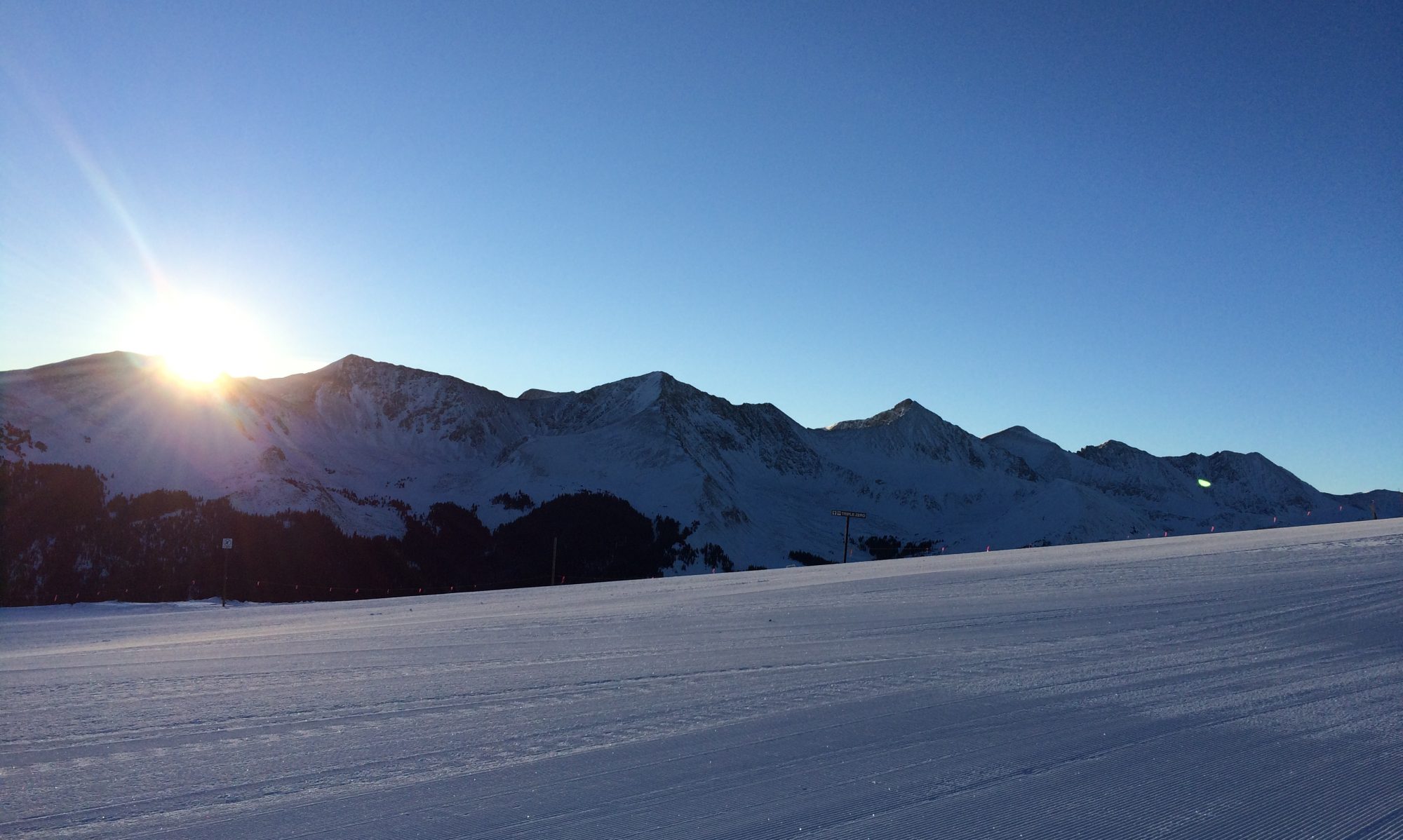
View from our window in Argentiére.

We made it safe and mostly sound to our home for the summer, Argentiére!  The weather here could not be nicer.  It is sunny and about 60 degrees and the Mont Blanc Massif is on full display.

Our travel was mostly smooth except for a delay out of Denver that caused us to be late for our connecting flight to Geneva.  As most of you know, M and I have been training quite hard of late.  What we didn’t realize was that we were training to sprint from Terminal D to Terminal C at Washington Dulles airport.  It was a half-mile race with only one big climb towards the end.  M and I were not first out of the starting blocks, but we made up significant ground on people who had not been training at altitude as we have.  As usual, M got into the lead and was first to our departure gate with me coming in about 2 seconds back.  Drenched in sweat, we presented our passports to the ticketing agents (kind of like finish line people who give you a medal after a race).  They assured us that we had won and would be allowed on the plane.  The nice stewards on the plane presented us with water as soon as we walked aboard and fortunately the air conditioning  was cranking so we could cool off.

As is usual for this flight however, we did not take off remotely on time and easily could have walked to the gate.  On the plus side, we did get in an excellent workout before sitting for 8 hours.  Fortunately we were able to be in Business Class so sitting is not too much of a burden since you can lie down fully whenever you desire. After a nice dinner for both of us we watched movies before turning in for a nice 3-4 hour nap.

We made it to Geneva about 8:30 am, and met our driver from Mountain Drop-Offs, Patrick. We highly recommend Mountain-Drop Offs as they are very friendly and take you door-to-door. This is the time when the sleeping on the plane comes in quite handy as you are able to stay awake for the drive to your destination.  When heading in to Chamonix, it is important that one be awake when nearing the town of Servoz.  Important because although the mountains can be seen for a large part of the drive, when you reach Servoz the Mont Blanc is on full display and it is HUGE!

At least for me, this being awake lasts until about 2 hours after arrival.  After that its nap time or else I start babbling, which isn’t that different from normal.  M has lived with me long enough however to tell the difference between normal babbling and, “Chris needs to take a nap right now,” babbling.

Since we invaded France with enough bags for a small army it took a while to unpack, but we are settling in nicely.  I hope to have pictures tomorrow!

Hopefully you all are well.  For those of you who are suppposed to be working out, get to it!

Au revoir,

Chris