Today has been a day of travel to Verbier. The trip by train from Zermatt to Le Chable was about 3 hours.
Interestingly, when one is traveling in the Zermatt area, the voiceover on the train (not Peyton Manning like at DIA) speaks in German, French and then English. The Zermatt area is mostly German-speaking with French and Italian and English being the other common languages. Once you switch trains at Visp and head towards Martigny, the voiceover on the train switches to French and English only because this part of Switzerland is French speaking.
Eventually the train stops at Le Chable and you get off to take either a bus or gondola up to Verbier. We chose to take the bus because it was sitting right outside next to the train.
The bus route takes you up a many switchbacked road which is very popular with people in fast cars and motorcycles. I saw a Ferrari pass a garbage truck in the middle of a switchback and no one seemed to think this was odd or dangerous.
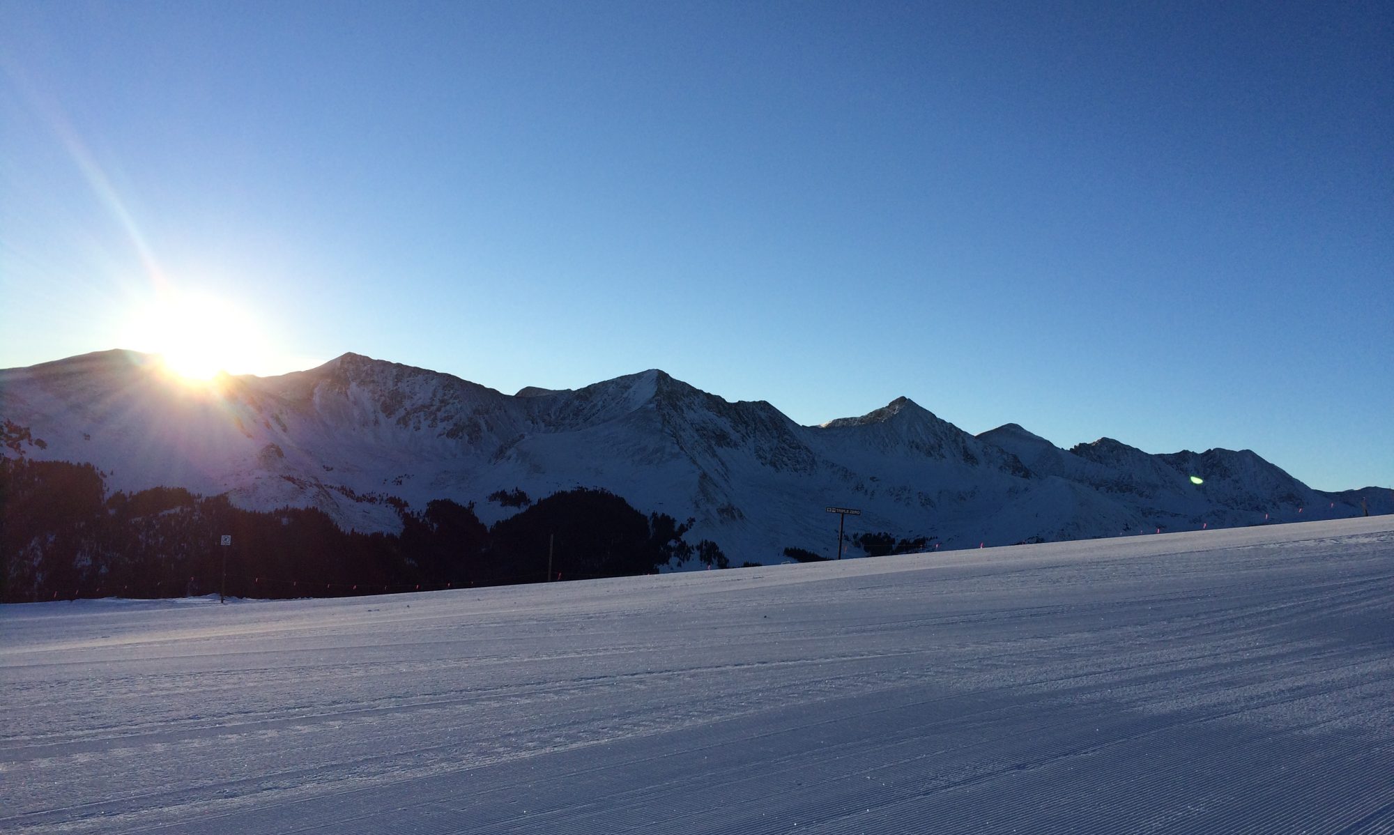
Verbier is a bigger town than Zermatt and it allows cars which will take a bit of adjusting to. Verbier also has no street signs to tell you which street you are on so finding your lodging is a bit of a guessing game. Fortunately M guessed correctly on her first try.
We thought Zermatt was a steep place to live but it’s nothing compared to Verbier. Since Verbier is on the side of the mountain there are only two ways to go. Up or down.
We will let you know how things are once we get settled.
Our leader thought today would be a good day to rise up (quite literally) against her fear and attempt to conquer the scary trail from Schwarzsee to the Hornli Hutte.
The Hornli Hutte is the starting point for climbing the Matterhorn as should be indicated by some of the pictures below. For mountaineers climbing the Matterhorn, the Hornli Hutte is where they sleep before getting awoken at 3:30 a.m. to begin the climb.
For normal people like us, just getting to the Hornli Hutte is a big challenge. We set off by getting our tickets for the gondola up to Schwarzsee. This started off as a good indicator as M was able to keep her eyes open almost the whole way up the gondola! That never happened a couple years ago when we first went up this particular lift.
We made it up to Schwarzsee with no rookie mistakes, like getting off the gondola too early, and found our starting point. Firstly we had to look straight up the mountain to see where we were trying to get to in 2.5 miles and 2,300 feet of gain however.
It’s a seriously daunting task and the Hutte looks so far away and so high you wonder if the trail really does go up there or if there is some sort of way to magic oneself straight into the Hutte. Then you notice the brightly colored ants marching their way up towards the Hutte and realize they are actually people so it must be possible.
The sign at our starting point says it should take two hours and ten minutes, but that is a really conservative estimate for the slowest people. M and I made really good time until coming to the scary metal walkway that hugs the mountain on one side and has a fairly nasty drop on the other side. M mustered up more courage than ever before (and possibly more curse words) and carefully made her way across the walkway.
After this point the trail gets flat for a little ways until the last half mile when it goes straight up in a series of switch backs on the side of the mountain. We were moving pretty fast, but just to give you an idea of how steep it is, our pace was 70 minutes per mile at this point. That’s right it took us 35 minutes to go half a mile.
Just for some perspective, there is what’s called a Strava segment for the last 1.8 miles of the climb. Strava is an app used by runners and cyclists to store data about their performances. Many top runners use this app so anyone can compare their time on any particular segment to those top runners. M and I were only about 15-16 minutes behind the best mountain runner in the world, Killian Jornet. Search his name on YouTube and you can watch him run up and down the Matterhorn (all the way to the top of the mountain) in under 5 hours I think. M and I finally made it to the Hornli Hutte an hour after starting. We were quite proud of not being too slow!
What goes up must come down however and that means crossing the scary walkway again! With more positive/negative self-talk from M we made it across and had a short celebration before continuing down the hill to our start.
We then rode the gondola back to town and celebrated with Rosti and eggs and ham along with some black cherry gelato! Gotta replace all those calories!
We consider this our biggest adventure ever just because of the difficulties overcoming a serious fear of heights. I am sure it will remain at the top of our list for a long time. Or until Saturday.
We’re heading up to just about where the snow startsAhh! The scenery!That mountain isn’t what should catch your eye – it’s the scary walkway!The Hornli Hutte and the MatterhornThe well-deserved reward
There is not much to report today. M and I decided to take the Gornergrat train all the way to the top of the Gornergrat, which is a bit above where our race finished yesterday.
For those familiar with the show, “The Night Manager,” starring Tom Hiddleston and Hugh Laurie, the Gornergrat is where most of the Zermatt parts of the show were filmed.
Part of the reason we wanted to get back up to the top is that we had run up this mountain back in 2015 as part of the Ultraks race and we remembered the views as being quite striking. During the race 2 years ago we didn’t get much chance to enjoy those views. Hopefully today’s pictures will give some perspective on the drama of the scenery.
We have a fairly big adventure planned for tomorrow so hopefully we will have more pictures to share.
Today was the Zermatt Half Marathon for M and I, and it really could not have gone better.
We got to the start area about 9 to check in and put our extra clothes in the proper bags and have them sent up to the finish area which was at Riffleberg. We then did a quick warm up and got herded into our starting corral. There are hundreds of runners so everyone gets put into a starting wave.
M and I started about 10:20 and I was immediately left in the dust by our entire wave because as usual the Euros started off at a sprint. Its 13 miles uphill people!
I lost M about mile 2, but I knew she’d be waiting for me at the finish. I was excited to see how well she would do as she’s pretty fast going uphill.
After mile 2 is when the race really starts as it’s a fairly steep grade all the way to mile 7. There is a nice downhill for about a mile then another short uphill to mile 8. After that is a nice flat part from mile 8.5 to 11.
Mile 11.5 begins the last big uphill and it’s a bear. Most people are hiking this section because they are tired by this point. Plus, unless you are an elite runner, hiking is more efficient due to the grade.
The very last part is an easier uphill from mile 12.5 to 13 with a small downhill finish where you can turn on the jets!
As usual in Europe there are hundreds if not thousands of fans cheering you along the whole way. There were only a couple of times I can remember there being no people cheering on the route. Most of those people are just out for their site-seeing hike in Zermatt, but Euros love mountain races so they get excited and cheer everybody on. The last part of the race runs right next to the GornergratBahn train (for those that don’t sprechen sie deutsch bahn means train so I used it twice in a row there) that goes up to the top of the Gornergrat mountain. The people on the train have the windows down just so they can scream, “Hop, Hop, allez, allez,” as they go by you. Even if you don’t speak German or French you get the idea. The thought did occur to me that hitching a ride on the train would have made the last hill much easier but I didn’t have the speed to catch it.
M finished in an amazing 2:35 and I came in with a very satisfying 2:51.
If anyone wanted to do a starter race in Europe this would be the one I would recommend because of the beauty and the overall organization of the race.
Now it’s time to refuel! And rest!
Cold & tired competitorsLooking down to Zermatt from about mile 9
I figured that since we were just sitting here in ugly old Zermatt doing nothing I would give a little update. The pictures will convey how awful it is here and how we are suffering through every minute.
Since we have been here we have run each day in order to better adapt to the new time zone and keep our legs ready to race on Saturday. Our runs so far are supposed to have been easy, but when all trails go straight up, easy becomes a relative term. Today we did discover the easiest trail in Zermatt! If you go down to the river and stay next to it you can have what is basically a flat run. The problem we have then is getting back to the place we are staying. The studio apartment is about 100 yards straight up a hill that averages between 10-15% grade. I may do a short video later of the hill and our apartment with short being the operative word.
As some of you may know, Zermatt is car free so everyone (locals anyway) walks or rides their bike everywhere they go. There is a local electric bus system that will take you up and down the street next to the river if you are not good at walking or are just lazy. Given the terrain, it’s easy to understand why most of the local’s bikes have electric motors on them. These are not the hidden electric motors that some pro cyclists have lately been accused of using, but are usually large obvious motors that aid a great deal in going up hill. A guy on his way to work yesterday scared me while we were on our run because he silently came flying past me going up a hill. Usually you can hear bikers going up hill because they are working hard but this guy was barely breathing. No worry about bikers on tomorrow’s run however!
Some of you may be wondering which race is tomorrow and I can tell you that it’s by far the “easier” of our two races. It’s only 13 miles with somewhere over 4,000 feet of gain. If I can finish in 4 hours it will be a good day for me, but I will not be pushing the pace by any means so we will see what happens.
Hopefully the photos below will convey our suffering accurately.
The obligatory Matterhorn Toblerone shotSo pretty every where!“Main Street” in ZermattA garden on our streetMore amazing mountains!
Well we are still traveling. It’s now been 20 hours since we left home and we have about 3:30 left on the train to Zermatt. We have as usual made some observations:
1. Euro women are not afraid to wear very tight pants whether or not those pants are a good fit and regardless of material. Be it leather or see-through white cotton.
2. We Americans value our personal space much more than people from other countries. People from other parts of the world are not shy about crowding when in a queue or anywhere else for that matter.
3. Americans are also still the most obvious group of people and it’s no wonder that people from other parts of the world recognize us before we even open our mouths. For some reason we Americans just haven’t learned how to travel quietly. And American men don’t generally wear pointy wizard shoes which are a Euro male law.
4. I now know why a lot of spy novels feature Hasidic Jews as diamond carriers who travel to Zurich for exchanges and banking. There is either some truth to the author’s tales or the Hasids are trying their best to fit into the storylines.
M and I have learned to appreciate DIA as far as airports go. There are bathrooms and water fountains everywhere, whereas in European airports both are a bit harder to come by. In fact we’ve never seen a water fountain. Fortunately for us they do have 2 grocery stores in the Zurich airport so water and snacks are readily available upon arrival. The smells from the bakeries in the airport are enough to make one just want to give up fitness and get fat. The Zurich airport overall is quite nice, however, and as efficiently Swiss as one would expect.
Going from the airplane to the Swiss train system is like going from a Metallica concert to a library. The quietness of the train is very relaxing and much appreciated after the noise of the plane.
Thursday:
This is a continuation of the thoughts above which I had written on the train. They might be a bit incomprehensible but I was/am pretty tired.
We made it to Zermatt yesterday afternoon and got some groceries and went for our first run. There are no easy runs here as everything is straight up hill. They are all beautiful trails though so it’s kinda hard not to stop and take pictures every 10 feet.
The internet at our place isn’t functioning yet so there may be a delay in updates. Also for those of you who are skiers, there is fresh snow on the mountains!
Seventh and last day on the TMB trail notes.
Gite le Moulin France to Chamonix, France.
Gite le Moulin sits just north of Argentiere, France which is just north of Chamonix which is where we began this adventure.
There is a lovely river trail that runs the entire length of the Chamonix valley following the Arve river. It is relatively flat and very well shaded. We began this part of the day’s trek with a nice walk after having a bigger breakfast. About 30 minutes in we began to run and felt quite good despite our aches and pains.
In under 2 hours we reached our original starting point and stopped our watches for the last time on this journey.
No those are not real people and yes that is an incredible painting on the side of a building in Cham. I am sure there are many famous people in the painting, but the one I thought I recognized was top right window on the left side of the balcony who I believe is Thomas Jefferson.
After 110 miles and 30,000 feet of vertical gain for the week M and I both felt we had achieved one of our greatest achievements yet. It was an amazing journey that seemed to end much faster than we expected. Thank you all for your support and for reading along during our trip.
Here are some more pictures…
Climbing up out of TrientThe cows in Switzerland are better than any cows anywhere else!Near Refuge Bertone outside of CourmayeurMont Blanc, from Chamonix, on the morning we leftTop of Col du Bonhomme
A fairly early start to this day had us leaving Switzerland and headed back to France. We were mentally prepared for some climbing, but we really had no clue about what was in store. It was another hot day so we were going through fluids early and often as the first climb of the Col de Forclaz kept going up with very few switchbacks and no gradients less than 20%. We then descended to the Col de Forclaz road where the Tour de France would be coming through the next day.
There were already many camper vans and other RV’s waiting at the road for the race to come through. Many amateur cyclists were making their own efforts at the climb as well. I was able to buy a hat to replace the one I lost somewhere along the way and we continued on towards the village of Trient.
Once the descent into Trient is made, the climbing continues up to the Col de Balme. The sign in Trient suggests that the climb to Col de Balme is 4 hours. I believe that’s because no matter how fast you go it seems like 4 hours. This was literally the longest and biggest climb we have ever done. We were very hot and there is only about 20 minutes of shade on the climb while the rest is done in the sun. Near the top is some fairly hairy scrambling because of snow crossing and the technical nature of the route. We were hoping it would be freezing cold at the top but there was barely even a breeze. We also ran out of water right when we got to the top, but we could see, “the hut that time forgot,” about a mile away.
Looking into France from the Col de Balme.
Yea, the “hut that time forgot,” in the distance.
Making our way to the top before the Col de Forclaz.
We reached the hut that time forgot which is so called because of the little old man and woman who run the place. The man doesn’t seem to speak and the old woman only speaks mean. She has the reputation of being a witch and it’s easy to see why. She is at least as old as dirt and has a nasty attitude. Everyone who does the TMB knows this little lady and marvels at the fact that she is STILL there and STILL mean. She reluctantly sells you a 1 liter bottle of water for 6 euros and then gruffly gives you an “au revoir,” which is translated as, “Don’t let the door hit you on your way out.” We were very happy for the water though!
After refilling and getting lectured on American politics by a chatty British fellow, we ran down through the Le Tour ski area. Our next climb was our last climb for the day and though it was flattish compared to what we had already come over it was extremely technical. Most of the route was up a gnarly ridge line with slanted rocks and stones embedded in the trail. The footing was such that you could never really take a step without carefully determining where you were going to put your foot. If you did not determine your foot’s destination beforehand you were asking for a face plant at best and broken ankle at worst. It was also a very deceiving climb because we kept thinking we could see and were near the top which we were not. Once forever had passed, we reached the actual top of the ridge and began what our guide described as a tricky descent. There were wooden steps involved for fun to go along with the, by now, usual steepness.
Per usual we got a bit lost looking for Gite Moulin but did manage to find it at the end of our second 20 miler in a row. The Gite was in a little green meadow filled with vegetable gardens and flowers. Some of those veggies became our dinner of veggies and potatoes.
We were so exhausted and hurting by this point that we looked for and found the easiest route back to Cham (that’s local speak for Chamonix) for the next day and decided that route was the one for us.
Fifth day on the TMB trail notes.
Refugio Walter Bonatti, Val de Aoste, Italy to Gite Bon Abri, Champex-Lac, Switzerland.
We sat next to Walter Bonatti at breakfast. Walter is dead but there is a very elaborate shrine with his ashes just to one side of the dining room. We didn’t notice last night but there you have it.
After that interesting start to the day we made our way towards Switzerland. We knew this was going to be a long day but we were hopeful of making good time because there were several flat sections. We did make good time at first with a 4-5 mile rolling to down hill section of the trail. At Refugio Elena the climb to Col de la Grand Ferret begins. Our guide said the climb was long but not steep. The climb was long and only not as steep as the climbs the day before but we did wonder if we would see the top. We finally made it and were able to cross over into Switzerland. That’s Italy to the left and Switzerland to the right:
We continued to make good progress for about the next 10 miles or so since a lot of the terrain was flat through a lovely Swiss valley with postcard-like villages.
At about mile 14 or so we began a gradual climb. It was definitely the easiest climb we have done so far but by the time we came to that section we were both so exhausted and dealing with various ailments that we slowed considerably.
At mile 21 or thereabouts we made it into Champex-Lac. There is a beautiful Lac (lake) that was so inviting we could not resist sitting in it for a bit to cool off and cool down some weary body parts.
After walking another mile or two we made it to the Gite Bon Abri.
Gite Bon Abri is a smallish hut situated just off the trail and surrounded by forest. We had a very good dinner consisting of salad and a sort of spaghetti sauce over rice. There was plenty of both so we both took advantage and got in plenty of calories.
We met lots of Scottish people at this hut, none of whom knew each other or were together. We also met a Welsh man who was doing what is called the Haute Route, which runs from Chamonix to Zermatt. He was in his mid sixties and not exactly fit, but he did appear to be determined. He was also very tired as evidenced by the fact that he is the first person I have ever seen/heard snore while being face down on their bed. This continued into the night but by this point in the trip we were becoming accustomed to the noise and were able to sleep through most sounds.
After looking at the map and studying our route, M figured on another 16 miles the next day which we then converted to actual miles and figured on another 20 miler.
As noted in the last email, we expected a shorter easier day on this day. We were correct in one aspect as it turned out to be only 9.5 miles or so. We were wrong in thinking that would be a rather quick, easy trip. It was our hardest day so far.
Getting out of Courmayuer, one has two options. Steep or “maybe they should put a ladder on this trail.” We did a little over 5,000 feet in about 6 miles. There were some scary ridge crossings that caused M some alarm but she soldiered on bravely. I was very proud of her because she is not a fan of paths that are only 4 feet wide with massive drops on either side.
We had decided not to run too much this day because we wanted to eat some of the bigger breakfast on offer at Hotel Dolonne. It turned out that it didn’t matter what we decided because the terrain would have prevented most running anyway, especially laden with heavy packs as we were. We did manage to run some of the route, but in our opinion we moved as fast and efficiently as we could have hoped for on such a tough day. M noted that it was our longest 10 mile day ever since it took us just over 4 hours.
Refugio Bonatti finally appeared so we put on a burst of speed in our excitement to be done for the day. You can find pictures of the hut on the interweb, but I can tell you they do not come close to doing the views the justice they deserve.
As the crow flies, the mountains are about a mile across the valley. The mountains are so big though that it looks like they are much closer and are about to fall over on top of you. Hopefully some of the pictures will give some idea of the size and majesty of this place.
This night was our first encounter with other Americans and there were quite a few of them. The first person we met was a girl we had passed on the trail who is from NYC. Next came a girl from Texas who was staying in the same room as us. We found it odd that both girls were alone but they both seemed adventurous. Also in our room for the night were two other American girls who were traveling together, and a Scottish man and his wife. Our dinner consisted of a salad followed by mashed potatoes with turkey. Also included were some bell peppers and onions. It was very filling and I had three helpings of everything. For the first time in this trip M and I had a dessert that we could not identify in any way but it was tasty.
We have another long day on Monday so it’s off to bed now.
The view across the valleyRefugio BonattiAlmost down!We just have to make it down to that saddle…


You must be logged in to post a comment.